De la resistencia a la ciencia: protegiendo las olas de Puerto Escondido
For more than a decade, the community of Puerto Escondido has worked to protect its waves and the coastal system that makes them possible.
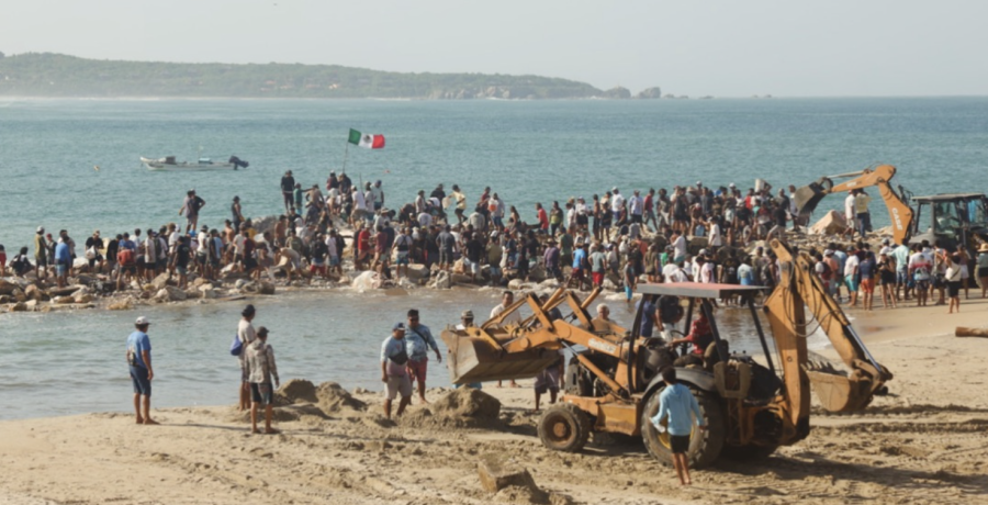
Part of this story is tied to the Bahía Principal breakwater, a structure that altered the natural transport of sediment and contributed to transforming the beach and ultimately as surfers have believed, the wave of Zicatela. Data and scientific studies showed that the beach has expanded by 25 meters over the past 20 years. Due to the growing concern of the jetty’s impact on the beach and surf quality, the community pushed for its removal for many years. After Hurricane Erick, which severely damaged the structure in 2025, hundreds of volunteers participated in community work days known in Oaxaca as ‘tequios’ which means community work for the collective good. This hard community work resulted in the removal of the remaining rocks and rip rap on the beach.
But removing the rocks raised a new question: How can we understand what’s happening to the wave in Zicatela beyond observed changes by surfers and the community?
The next step had to be science.
Thanks to donations raised through an online fundraising campaign executed locally and distributed internationally, it was possible to conduct the first high-resolution bathymetric and photogrammetric survey of the beaches of Bahía Principal, Marinero, and Zicatela, with a technical team of specialists from UNAM (National Autonomous University of Mexico). The project allowed us to integrate seafloor measurements with aerial imagery to build a detailed baseline of our coastline.
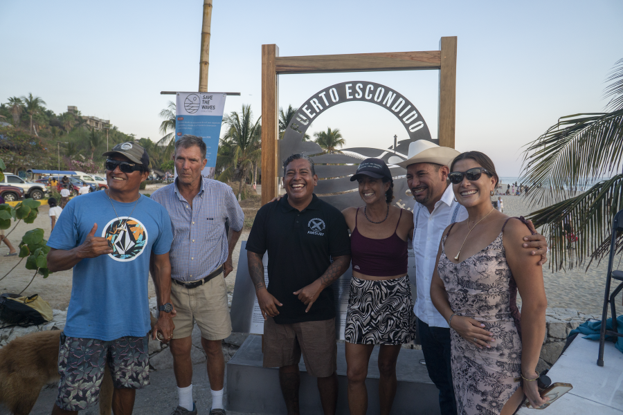
It was also a true community effort. AMISURF (Association of Mexican Surf Instructors) volunteers helped by safeguarding the antennas used during the survey, while local businesses such as Spirulina, El Cafecito, and Thai Garden sponsored meals for the team. They were joined by the Puerto Escondido Photographers’ Association, Save The Waves, and everyone who donated, participated, and believed in the project.
The results revealed important features that had been poorly documented until now, including a deep underwater channel off Bahía Principal and the rock formation known locally as “El Muro de Piedra.” The study also provides new insights into sediment accumulation and transport and, crucially, how underwater morphology influences our waves.
The results were shared with the community via an open webinar, available on our YouTube channel.
Now the next phase begins. We are conducting weekly drone monitoring and will soon hold community workshops to create beach profiles.
Our goal is to build a long-term body of scientific knowledge that will allow us to detect changes and influence public policy to prevent future projects from altering the coastline, sediment transport, and our waves.
The results were shared with the community via an open webinar, available on our YouTube channel.
Los resultados fueron compartidos con la comunidad mediante un webinar abierto, disponible en nuestro canal de YouTube.
De la resistencia a la ciencia: protegiendo las olas de Puerto Escondido
Durante más de una década, la comunidad de Puerto Escondido ha trabajado para proteger sus olas y el sistema costero que las hace posibles.
Parte de esta historia está ligada al rompeolas de Bahía Principal, una infraestructura que modificó el transporte natural de sedimentos y contribuyó a transformar la playa (la playa creció 25 metros en los últimos 20 años). Durante años, la comunidad impulsó acciones para lograr su remoción. Después del huracán Erick, que dañó severamente la estructura en 2025, cientos de voluntarios participaron en tequios para retirar las rocas que permanecían sobre la playa.
Pero retirar las rocas planteó una nueva pregunta: ¿Cómo podemos saber qué está ocurriendo realmente en Zicatela?
El siguiente paso tenía que ser la ciencia.
Gracias a donaciones recaudadas a través de GoFundMe fue posible realizar el primer levantamiento batimétrico y fotogramétrico de alta resolución de Bahía Principal, Marinero y Zicatela, con un equipo técnico de especialistas de la UNAM. El proyecto permitió integrar mediciones del fondo marino con imágenes aéreas para construir una detallada línea base de nuestro litoral.
También fue un verdadero esfuerzo comunitario. Voluntarios de AMISURF apoyaron resguardando las antenas utilizadas durante el levantamiento, mientras negocios locales como Spirulina, El Cafecito y Thai Garden patrocinaron alimentos para el equipo. A ellos se sumaron la Asociación de Fotógrafos de Puerto Escondido, Save The Waves y todas las personas que donaron, participaron y confiaron en el proyecto.
Los resultados revelaron importantes características hasta ahora poco documentadas, incluyendo un profundo canal submarino frente a Bahía Principal y la formación rocosa conocida localmente como “El Muro de Piedra”. El estudio también aporta nueva información para comprender la acumulación y el transporte de sedimentos y, fundamentalmente, cómo la morfología submarina influye en nuestras olas.
Los resultados fueron compartidos con la comunidad mediante un webinar abierto, disponible en nuestro canal de YouTube.
Ahora comienza la siguiente etapa. Estamos realizando monitoreos semanales con dron y próximamente desarrollaremos talleres comunitarios para realizar perfiles de playa.
Nuestro objetivo es construir información científica a largo plazo que nos permita detectar cambios e incidir en las políticas públicas para evitar que futuros proyectos alteren el litoral, el transporte de sedimentos y nuestras olas.